A small town that might have existed…
or perhaps, all the small towns that do exist.

Welcome to Willow Mills
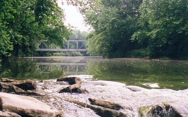
WILLOW MILLS, INDIANA is a fictional town. It has no corollary in the real world. In fact, it intersects with the real world in only one place—a rock about three feet across out in the middle of the Eel River within six or seven miles of North Manchester, Indiana. It’s a rock on which I sat some years ago writing poetry and dreaming of what I would do with my life.
The dreams and poetry have gone the way of dreams and poetry. But the rock is still out there, resisting the gentle current of the Eel River. And it probably will still be there long after the village of Willow Mills has also gone the way of dreams and poetry. The citizens of Willow Mills hope you enjoy your visit and invite you to come back often.

A Guided Tour
The name Willow Mills comes from the name of the little creek that runs into the Eel from the north just across from the village. The village is built along the south bank of the river where Bert Grissom built the original mill. There is an old iron bridge that crosses the river just above Grissom Falls.

It’s necessary to have the bridge because Willow Mills United Methodist Church is on the north side of the river, built in the fork between Willow Creek and the Eel. It sits over there like the laird of a Scottish castle overlooking the village it calls its own.
South River Road
South River Road more or less follows the river all the way from the Kosciusko County line to Chili. (That’s Chili, Indiana, just east of Peru.) Two blocks west of the iron bridge, Main Street turns south off the River Road. If you follow it out of town to the south it cuts a straight line through some of Indiana’s richest farmland to the Wabash River, seventeen miles away. There is no bridge at either end of the road. It ends at the Eel River on the north and the Wabash River on the south.
We don’t know why the River Road is called the South River Road. Yes, it is mostly on the south side of the river, but there is no road on the north side. Maybe at one time they intended to put a road up there. We just don’t know.
Willow Mills United Methodist Church isn’t much to look at, but it’s the first thing you encounter coming into town. It’s the kind of square red brick building that could be a factory or a school except it has big arching stained glass windows and a bell tower over the front entrance. After unification of the Methodist and EUB churches back in 1969, the conference tried to combine this congregation with two or three other small churches in the area. But they resisted. The closest they ever came was sharing a minister with a church over the county line. For a long time, they would have a minister one week and the other church would have him the next week. The other church closed its doors though, after the last of the congregation went into a nursing home. Now Willow Mills Church is happy to have retired ministers assigned to them by the conference, and for not paying much, they treat their minister well.
There’s a Baptist congregation just west of town. It started out as a house trailer parked on a couple of acres just where the river bends in an oxbow and the road takes the shortest path across. The trailer is still there, but now there’s a building kind of pieced together around it. The biggest feature is the church’s easy access to the only sandy stretch of the Eel for about twelve miles in either direction. The congregation makes good use of that stretch as their baptismal. It also functions as the town’s free beach swimming hole in the summer. The church doesn’t do baptisms in the winter.
Jess & Jim’s Pyramid Oil Company gas station is at the corner of River Road and Main Street. And a three way stop with a flashing red light. Opposite the gas station is Rasmussen’s Farm Implement Sales and Service.
Main Street
A block south on Main Street, the street widens a bit. There are three traffic lanes and diagonal parking on each side. It used to be that there were four lanes and parallel parking, but Mrs. Leland put up such a fuss after she hit Ogden Filmore’s truck while trying to park, that the town voted unanimously in town meeting to repaint the stripes on the road.
The wide part of Main Street is two blocks long. The other block south is two lanes with parallel parking, and after you cross the tracks, there’s no curb or shoulder to park on at all.
It may seem strange that a town our size has such a wide (and short) Main Street. My understanding (and I got this from one of the old timers in town) is that the street originally ended a block short of the River Road (or that River Road used to be a block nearer to town—it’s hard to make sense of some of these stories). When the town was platted it was determined that they would need a street wide enough to turn a full team of horses with a loaded wagon around in.
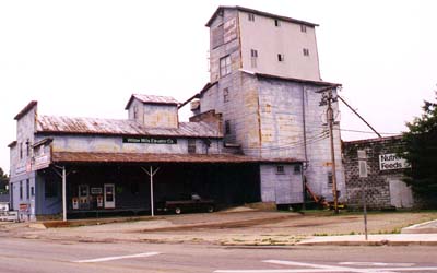
Every year on the 4th of July there is a parade that goes from Elsie Hewitt Elementary School, west into town, and then south down Main Street to the Grain Elevator. Angus Fergusson still drives a team of horses in the parade and shows in each block of Main Street how he can turn the team and loaded milk-wagon at a full gallop around in the street.
Fountain Square
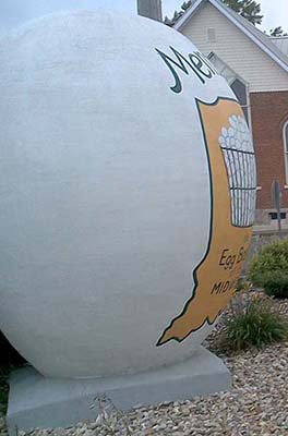
At the center of town, a memorial fountain and a 4-way stop interrupt the Main Street. The statue is a twelve-foot stainless steel milk can, proudly declaring Willow Mills as the dairy capital of Indiana. It was erected in 1953, mostly just to show those cattle rustlers in Mentone (with their giant cement egg) who was boss.

In reality, Angus Fergusson’s dairy farm is the only one left in the area. All the other cattlemen long ago went to more lucrative beef farming, feeding the animals on the rich crops of corn that are rotated year after year with soy beans. That’s another story.
Around the milk can stands the center of commerce for Willow Mills. The Eel River National Bank is on the southwest corner—an imposing red brick building. On the northwest corner, its near architectural match is the Post Office. Across from the bank on the southeast corner stands one of Willow Mills’ oldest businesses: Oppenheimer’s Drug Store. And finally, completing the circuit on the northeast corner is Willow Mills’ only hotel, a fine three-story brick building, sometimes called The High Rise. It has become mostly a residence hotel, and anyone wanting a room for just one night is looked at somewhat askance.
South of the Tracks
Two blocks south of the center of town is the railroad track. The founding fathers felt that by putting the town smack between the River on one side and the railroad on the other, they would have transportation and commerce pretty well taken care of. That would assure the town’s position and future growth, either north of the river if water traffic proved best, or south of the railroad if rail traffic proved central.

Unfortunately, no one counted on trucks and highways and all the main state routes run at least four miles away. So, commerce and transportation sort of passed Willow Mills by.
When you cross south of the railroad tracks you enter the part of Willow Mills that is part highbrow exclusive neighborhood, and part trailer trash. Sometimes they are hard to tell apart. Section Line Road lies just south of the railroad. Just a ways past the Section Line Road on the east is the entrance to Willow Woods, a planned unit development of the early sixties. There are 43 manufactured houses and several empty lots along the haphazard system of dead ends and loops that pass for streets. It has only one exit.
It backs up directly to another Willow Mills neighborhood. It's what most of us call String Town. It’s pretty much shacks and mobile homes that started out huddled between the tracks and the Section Line Road just beyond the feedlot. It spills over the road now along a spiderweb of dirt roads that all run into “The Lake.”
The Lake is a five-acre fishpond that used to be the primary watering hole for Milo Stoneburner’s beef cattle. The south edge of the pond still borders the Stoneburner property, but there haven’t been cattle on the land since Milo passed on, oh, ten years ago. And as for fish in the pond—I don’t think so.
The Farmlands
We’ll make two more stops on this little tour. They are both west of Main Street and south of Dry Well Road. The bulk of that area, lying along both roads is taken up by the 260 odd acres of Angus Fergusson’s Dairy Farm. Angus has modernized the place and now you can pull in of Dry Well Road and watch through glass viewing panels as each night and each morning his 300 dairy cattle march in from the field, get washed down, and stand quietly to chew their cud as the very latest in electronic milking machines relieves their sagging udders of fresh whole milk. If you bring your own jug, you can fill it straight from the big stainless steel cooler for just 99 cents a gallon.
Just beyond the Fergusson place on Section Line Road, the ground rises in one of those odd bumps that are common in the Wabash Valley. At the top stands a tiny deserted church called Summit Chapel. Surrounding it, overlooking this Hoosierland paradise is the Summit Cemetery where 150 years of our ancestors have found eternal rest.
Comments
Please feel free to send comments to the author at nathan@nathaneverett.com.
